Andrew Bonwick
Vice President of Product Development at Relm Insurance

Madhav Sheth
CEO of Ai+ Smartphone

Varun Kashyap & Sridevi Reddy
Co-Founders, Zithara.ai
Transforming Indian Offline Retail and Customer Engagement Using AI
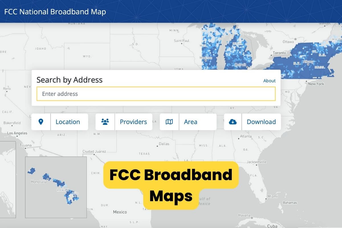
The Federal Communications Commission (FCC), which oversees national and international communication through different cable, satellite, wire, and cable in the US, has unveiled the pre-production draft of its new national broadband maps. The FCC believes the maps will only get better from here since they now give the best picture of where broadband is and is not available across the nation.
- Make Telecom Talk My Trusted Source

Broadband Maps Empower Consumers
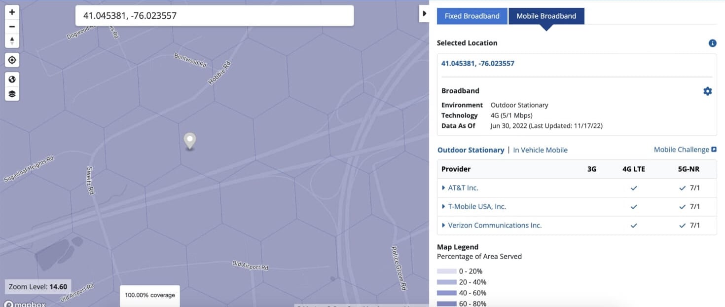
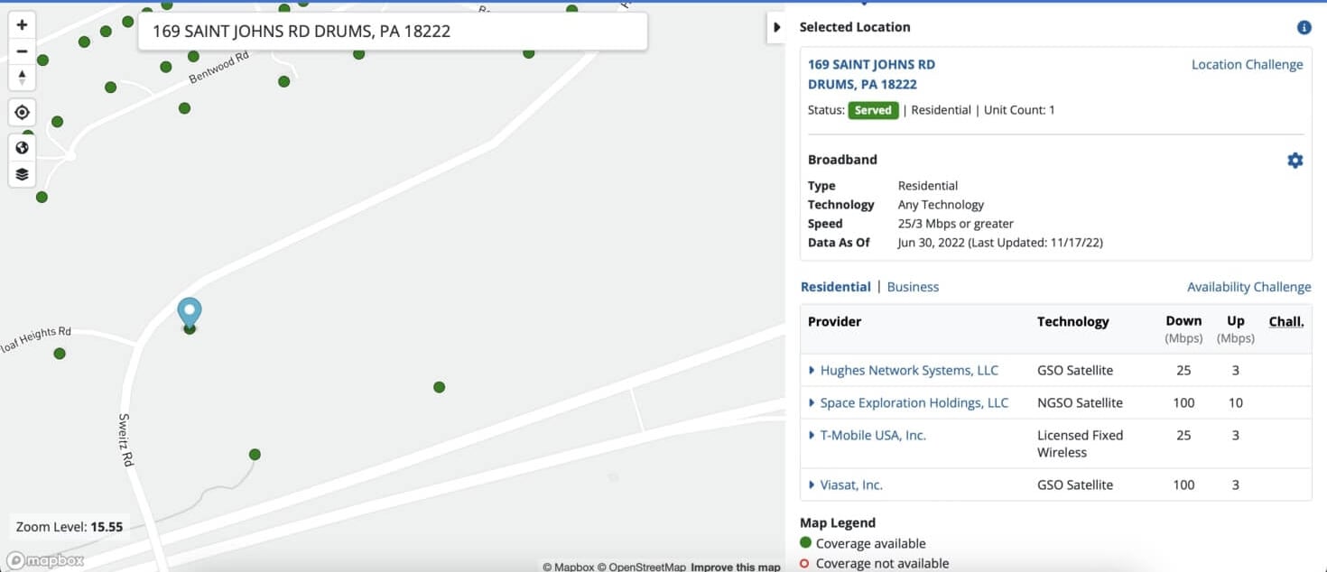
With the new maps, the FCC has integrated the information from broadband providers with hundreds of location-specific data sources, giving a detailed and accurate picture of fixed broadband availability which helps consumers. This information will also help policymakers target investments in unserved and underserved areas and close the digital divide.
Source: FCC
Beginning of a New Era of Broadband Maps
While the day marks an important milestone in creating more granular and accurate broadband maps, this work is far from over. To emphasize how much more work needs to be done, FCC calls the Maps product a pre-production draft. Releasing this early version of the new maps is intended to kickstart an ongoing, iterative process where we consistently add new data to improve and refine the maps.
Also Read: FAA to FCC: Require 5G C-Band Limitations Near Airports