
Andrew Bonwick
Vice President of Product Development at Relm Insurance

Madhav Sheth
CEO of Ai+ Smartphone

Varun Kashyap & Sridevi Reddy
Co-Founders, Zithara.ai
Transforming Indian Offline Retail and Customer Engagement Using AI
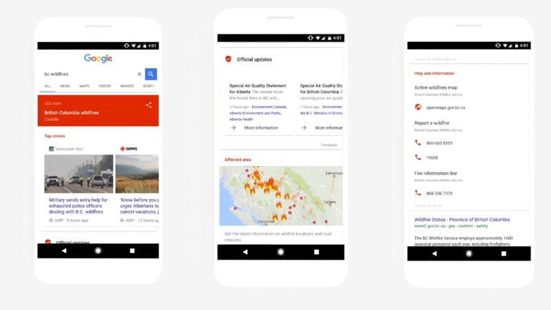
Google has added a new tool to its Search and Maps service called the SOS Alert to help users get easy access to actionable information in times of any natural, man-made or other crisis. The internet search giant intends to help its users promptly and effortlessly figure out where and how they can stay safe when disaster strikes.
- Make Telecom Talk My Trusted Source

The new feature will display a feed with top stories, emergency hotlines and websites, authoritative local information, and other helpful information like a translation of useful phrases and terms. The new SOS Alert also sends mobile notifications to users in close vicinity to affected areas directing them to the same information.
The company claims that this functionality would help not only people in crisis but also the unaffected users looking for relevant information on the situation. When the SOS Alert feature is activated, Google Maps will tell you which areas to avoid, traffic and transit updates, real time road closures and more.
“During a crisis, people need real-time information. Whether they’re experiencing an issue on the ground or trying to understand the situation from afar, we want our products to give people quick access to important information — such as what is going on and where it is happening — to help them stay safe and informed,” Google said.
At the time of a crisis, all users will see a ‘specific icon’ on the map along with ‘tappable card’ which will direct you to emergency services and other information. Google has partnered with a variety of government bodies such as the Federal Emergency Management Agency, Red Cross, and similar organisations to develop the SOS Alerts feature. This feature will be available in 12 countries including India, Philippines, Brazil, US, Mexico, Australia, and Canada.
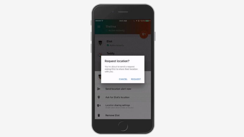
In an event today, Google also announced new features to its Trusted Contacts in addition to introducing the app to iOS platform. Google’s Trusted Contacts made its debut last year on Android and starting today; the iOS users will be able to reap the benefits of this app. The iOS users can download the Trusted Contacts for free via the App Store.


